Radbourne
The Spencers of Wormleighton (SP 448 536) were sheep barons; reputedly the richest family in England at the start of the 17th century. The area to the north of the village is, I've been told, the largest in England without a road running through it – possibly because William Cope, from whom the Spencers bought the manor, had demolished 12 farms to make way for sheep. (Cope had been treasurer to the household of Henry Vll.)
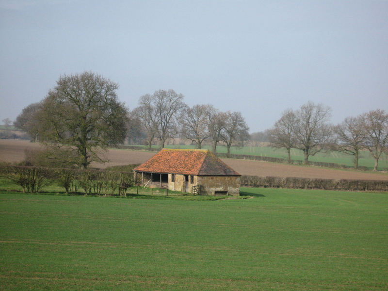
The Spencers* peppered their land with beautiful barns too (#1) – there are two more of the same pattern at Charwelton – and you can still see a large 'washbrook' and square lairage field where the sheep were cleaned and then pastured before shearing.
In other words, the layout hasn't changed much since 1600.
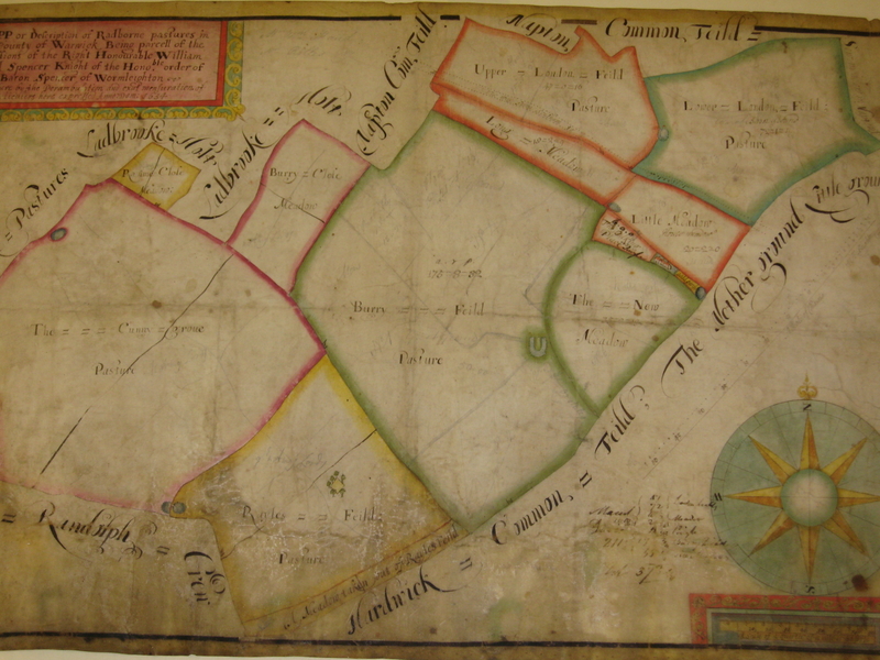
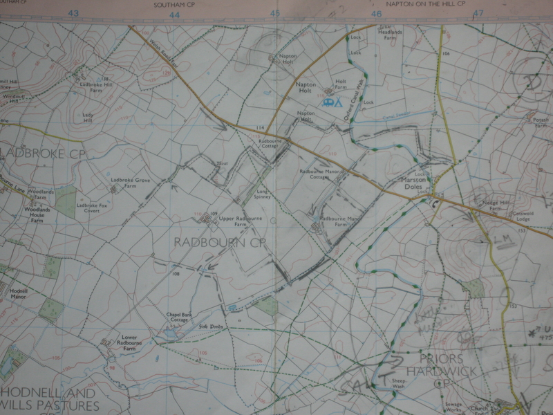
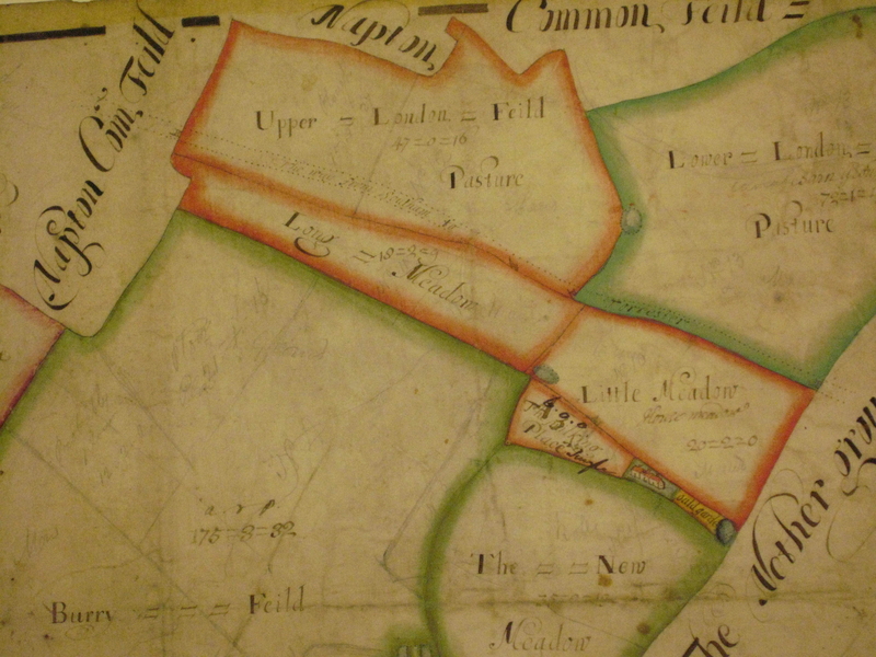
In Warwick Record Office there's a map of part of the estate (“Radbourne Pastures, 1634”) which proves this: compare the field pattern shown in the 1634 map (#2) with that shown in the modern OS map (#3).
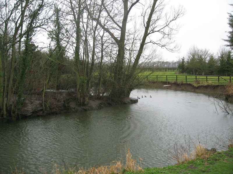
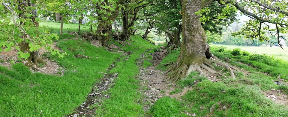
The horseshoe-shaped pond at the RH edge of the largest field is still there too (#4), on what is now Radbourne Manor Farm.
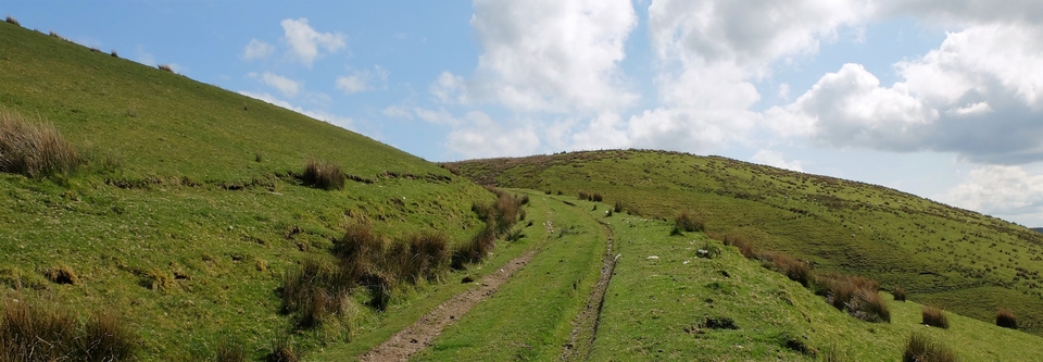
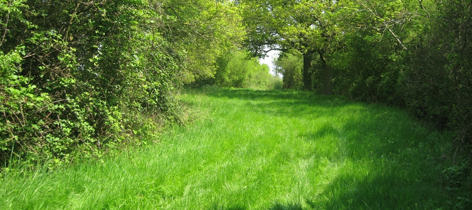
The short stretch on the map is part of Welsh Road East, about three miles south east of Southam. Now look at the enlargement of the 1634 map (#5)and you will see a pair of faint parallel dotted lines just above Long Meadow and Little Meadow, wandering along the southern edge of ‘Upper London Field'. And inside the lines is written ‘The Way from Southam to ... Torcester'. (Can you spot the gates?)
Towcester doesn't feature on drove routes at all, but it was a staple town. Edward lll established these as a means of taxation: the export of wool (or leather, lead and tin) to the continent must pass through a staple town to be valued. So perhaps it was an important route for the Spencers.
(The Towcester road is still there: it goes via Priors Marston, Charwelton, Maidford, Blakesley and Greens Norton. A stunning ridge road which I deal with under ‘Northants'.)
The road on the Spencer map was also part of the drovers' route, but only until SP 469 582. There the Welshmen veered off southwards, just after Marston Doles, to Priors Hardwick…
* The OS map shows a vast loop in the Oxford Canal (square 43 55) to provide water for the Spencer sheep in every field. No loop, no canal, was the ultimatum. If the family still had the same power they might stop HS2 going through this lovely area.
(PS Apologies for the scruffiness of #3. I must do it again. Also thanks to the Kenilworth historian John H. Drew, whose article 'The Welsh Road and the Drovers', written in 1965, started me on this stretch.)